
Walker Livingston, Carolina Public Press
The North Carolina Welcome Center on Interstate 26 near Tennessee sits on land that used to be an apple orchard in Madison County, right on the state line. Another nearby stretch of I-26 has become a hot-button issue in nearby Asheville right now, with a billion-dollar I-26 connector project breaking ground early this year.
Controversy over I-26 through the region between Asheville and the Tennessee line is anything but new.
The part of the highway in Madison holds a longer history fraught with moving whole communities while constructing 9 miles of remote highway up to the Tennessee border. The original $230 million project in Madison took almost four decades from its inclusion as an early Appalachian Development Highway to its completion and grand opening on Aug. 5, 2003.
The Welcome Center displays T-shirts today, just a few miles away from the town of Mars Hill, that read in bold blue font, “Opening the Missing Link,” with a map of the county from that opening day.
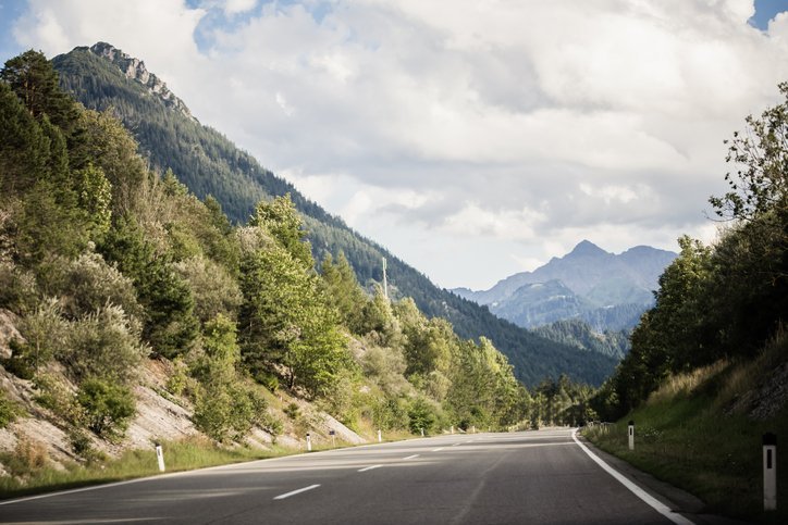
That “link” of the highway in Madison County is what some call the “Little Parkway,” because of its scenic nature that rivals the Blue Ridge Parkway. I-26 near the Tennessee line cuts through some of the most rugged mountains east of the Mississippi River. It was one of the largest earth-moving projects ever conducted by the state of North Carolina — 37.5 million cubic yards of earth were moved for those 9 miles of interstate.
While that missing link was an I-26 connector project, today the phrase “I-26 connector project” means something different to Western North Carolina residents. It’s the project in Asheville that is updating 7 miles of the highway system through Asheville from the Interstate 40 interchange through the city to U.S. 19/23/70 north of Broadway Street.
That stretch of highway, too, is fraught with a history of moving and developing existing communities for the sake of better infrastructure and progress. The interstate is a part of a decades-long conversation about how to best develop in the rural and urban parts of the South.
Documenting the I-26 ‘Missing Link’
Rob Amberg is a documentary photographer and longtime Madison County resident who spent years photographing rural life in Madison County while those 9 mountainous miles were being built. Amberg arrived in Madison in 1973 and has stayed since — he ended up making a book titled “The New Road,” about the community and its rural progress.
Amberg shot photos and conducted oral histories with hundreds of county residents, including those who were displaced by the roadway. Residents felt every possible way about it; some were heartbroken about the properties that were moved for the highway while welcoming the possibility of economic development and easier travel in the remote county. The NC Department of Transportation used eminent domain to acquire 500 acres.
The project brought difficult moments. In 1996, families gathered daily for two weeks to watch the graves of their loved ones be unearthed from the Little Ivy Church Cemetery and moved to a new location. Amberg documented this, as well as when DOT began the dangerous, physically involved work of rock blasting for the interstate.

“We’ll start seeing subdivisions and everything else,” Darhyl Boone, who was town manager of Mars Hill in 2000 during the Interstate’s construction, said in an oral history with Amberg, which is now in UNC’s Southern Historical Collection. “It’ll change us. That’s the thing that scares me.”
He told Amberg that he was scared the younger generations would cease farming in the agricultural county, but also remarked on the community needing more money. Boone was not alone in his sentiments, and many other rural communities are still reckoning with development today.
“Initially I thought, well, I’ll get a few pictures and add that to my story,” Amberg said. “It turned into a whole new project on its own.”
Through his work, Amberg believes he has preserved a kind of old way of living, which is still lingering in Madison County, he said. Amberg went on to make two other photo books, both documenting rural life in the county. While the county is still rural, development of storefronts and tourism has increased since the highway was finished.
Across North Carolina, communities are reckoning with changing rural landscapes. When the N.C. Rural Center added a suburban and regional city category in 2015, a growing number of the state’s counties have been reclassified from previously rural designations as their populations have grown.
Building Appalachia
Construction of those nine miles of I-26 in Madison County was announced in 1965, but it took 27 years until the project broke ground in 1993. Tennessee completed 16 miles of I-26 from the town of Erwin to the North Carolina state line in 1995, leaving North Carolina with the remaining highway gap. Amberg said at some points, residents had given up hope that there would ever be a highway there.
Madison County is rugged. An early producer of tobacco, the county still has a largely agricultural economy. Areas along the highway have become bedroom communities for Asheville since the development of the interstate, with many Madison residents commuting to the city for work. Asheville and the Tennessee Tri-Cities area were largely unreachable from part of Madison County before the highway’s development because of mountainous terrain.
“It goes beyond infrastructure,” Janiene Bohanon, the director of communications for the Appalachian Regional Commission, said. “It’s water infrastructure. It’s broadband. It’s local access roads. It’s so many, so many things that are required in order to see that growth, that economic growth.”
When John F. Kennedy was running in the 1960 Democratic presidential primary, he campaigned heavily in rural West Virginia because he was trailing behind elsewhere. While making more than 100 campaign stops in the mountainous state, he noticed high levels of poverty and a lack of roads connecting mountain communities, especially isolated “hollers.”
After support from the state pushed him to win the primary, and later the presidency, the Conference of Appalachian Governors asked Kennedy in 1963 to create a commission addressing Appalachian needs. Kennedy responded by establishing the President’s Appalachian Regional Commission.
The commission’s first report came out in 1964, after Kennedy’s assassination. Original states served by the commission included West Virginia, Maryland, Alabama, Georgia, Virginia, Tennessee, Ohio, Pennsylvania, South Carolina, Kentucky and North Carolina. Its initial report called problems facing the region “unusual”— and they certainly were to outsiders from coastal cities in the Mid-Atlantic and North. Those “unusual” problems included isolation, poverty and lack of access to education, nutritious food and healthcare.
The first need that the report identified was the lack of road systems. The Madison County route was incorporated into the Appalachian Development Highway System in 1973.
“Developmental activity in Appalachia cannot proceed until the regional isolation has been overcome,” the initial report from the ARC report states.
So, then came the Appalachian Development Highway System. Rather than expanding existing highways, these new developmental highway systems that would touch remote Appalachian communities would induce traffic and growth while relieving isolation in the region, said Tom Smith, a senior transportation adviser with the Appalachian Regional Commission.
Asheville’s Malfunction Junction
Interstate 26 runs around Asheville in a roundabout way, merging with other highways and streets to funnel traffic into and around downtown Asheville. At its most congested point, where it crosses the French Broad River just west of downtown, some locals call it, “Malfunction Junction.” There’s a popular social media page with thousands of followers dedicated to hating the freeway. Even a local band took its name from the connector project.
In the 1950s and 1960s, homes in the historically Black community on Burton Street were demolished for the construction of Patton Avenue and the Bowen Bridge in West Asheville. Later, homes were also demolished for the construction of I-240, which was part of an era of urban renewal and highway building that displaced roughly half of Asheville’s Black population, most heavily in the nearby Southside neighborhood. Many of the affected neighborhoods had been redlined in the 1930s, when federal maps marked them as high-risk and cut residents off from home loans.
Now, the connector project wants to widen a segment of the road, which will require a new right-of-way in the community, which has been designated as an Environmental Justice population by DOT because of impacts from the decades of construction that residents have endured. This project is the third time that homes in the community have been affected by the road.
The agency has said unavoidable impacts on the community would be mitigated through additional public outreach.
The current I-26 project in Asheville was first proposed in 1989. Like the now-completed Madison stretch, it has been a long time coming. The environmental impact statement was signed in early 2020; the final decision was signed in 2023, and construction began this summer.
It has four goals stated by DOT— to update the corridor from I-26 south of Asheville to US 19-23, address deficiencies in I-240 like delays and traffic crossing the Bowen Bridges, and reduce traffic congestion on Patton Avenue.
Although the pavement is continuous, technically the existing I-26 ends abruptly in the southwest part of the city, and drivers merge onto Interstate 240 for four miles and cross the Jeff Bowen Bridges over the French Broad River. When drivers exit 240, they get on US 19-23 towards Madison County, whose markers label it “Future I-26,” because it does not yet meet federal interstate standards.
Construction has recently begun on the I-26 connector project in Asheville, which will work on 7 miles of the freeway and build new parts of the highway on Haywood Road, which is in the western part of the city.
Once again, it’s a controversial project — DOT has bought out businesses and homes on the road, which now face demolition, closure and potential relocation. Asheville alt-weekly Mountain Xpress reported that these businesses and homes are facing uncertain futures and community members are upset about their uprooting. The project was reevaluated in March 2026 because of changes made since the 2023 Record of Decision, according to DOT.
“The federal highway and the state DOTs have the environmental process that tries to understand what the issue is we’re trying to solve with this highway,” Smith said. “When they identify what the issue is, then they say, ‘What are the alternatives that could resolve that particular issue?’”
A popular flyover ramp on I-240 that connected Patton Avenue to Westgate Parkway permanently closed on Aug. 2. Community members expressed disappointment about the closure on social media, as the flyover allowed direct access to the Westgate shopping area, which is now difficult to reach from the west. In recent years, West Asheville has become congested with traffic from 240, but some residents worry that this project will make traffic worse and box in the community.
Michelle Myers is the chair of the East-West Asheville Neighborhood Association, or EWANA, which is a part of the city that encompasses the area between the French Broad River and Interstate 240. Since construction has started, her street has seen an increase in traffic from dump trucks and noise pollution. She said that 10 neighbors who had homes near the project were bought out by DOT.
EWANA hosted a listening session with DOT on Sept. 23 to discuss the ongoing project. Myers said many city officials and neighborhood residents attended and brought questions about the timeline of the project to transportation officials. Some asked about the closure of Westgate Plaza, which has rerouted traffic onto residential streets in the neighborhood.
“This closure allows crews to safely move into the next phase of the project while maintaining access to the Westgate area,” NCDOT Division 13 construction engineer Nathan Moneyhan said in an agency press release about the closure. “We appreciate the public’s patience as we continue building these long-term improvements.”
DOT also introduced the process for adding a sound wall to homes impacted by the corridor to decrease noise pollution. Individuals with a noise impact determined by a sound study will be able to vote on the wall.
Myers said she is glad that the neighborhood was able to have a conversation with DOT, despite her worries about the long-term impacts of developing highways like I-26. She’s worried about the tree loss in the corridor, especially after damage from Tropical Storm Helene in 2024. She said this project might push folks out to more rural areas, which in turn creates single-family home developments in former agricultural land. In Henderson County, which is reachable by I-26, farmland is decreasing at a high rate— and residential development is a factor.
“All over North Carolina, we’re expanding our freeway system and we’re creating a development style that we, at this stage, know is not sustainable,” she said.
Appalachian highways in rural Western NC
Sixty-one years after its inception, the Appalachian Development Highway System is about 92% complete and spans 3,090 miles. It designates its highways as corridors, and I-26 in North Carolina is considered part of the ADHS’ “Corridor B,” connecting Asheville to Lucasville, Ohio.
Smith himself is a native of Ashe County in northwest North Carolina. He said when he went to school at NC State University, he thought his small hometown of West Jefferson would “disappear.” While it was not the ADHS that developed the roads near there, the commission increased investments in developing rural, mountainous roads across Appalachian states.
“Part of the reason that the interstate system largely missed Appalachia was that it was so expensive to build roads there, and you have to worry about geotechnical considerations, about landslides,” he said, and added that building I-26 was particularly difficult because of the terrain near the N.C.-Tenn. border.
The 1,000-foot-long Laurel Creek Bridge on I-26 was the first bridge in North Carolina to have a de-icing system. The highway crosses the NC-TN border past the bridge at scenic Sam’s Gap, which sits at 3,760 feet above sea level. It also runs parallel to the Appalachian Trail and was a landmark ribbon-cutting and groundbreaking when the road was completed.
Stephen Henderson was mayor of Woodfin in northern Buncombe County in 1995 when the missing link was being built.
He said the highway has done a lot for growth in Weaverville and Woodfin. He added that the highway hasn’t had the same amount of impact in the Madison County towns of Marshall and Hot Springs because it doesn’t follow the French Broad River. If it had followed the river, it could have brought more tourism funds to those communities, he said.

“It definitely helped Weaverville and Woodfin grow, but it hasn’t done what it should for Madison County,” he said. Weaverville and Woodfin are two towns along the highway in northern Buncombe County.
A far-off, finished I-26
When the Madison County portion of the highway was completed, so was Corridor B. Dillsboro in Jackson County, is the eastern terminus of Corridor K, an incomplete segment of the ADHS which would extend from southwestern NC to Cleveland, Tennessee, near Chattanooga.
The controversial Asheville I-26 connector facing roadwork today, which has to navigate doing construction in existing communities instead of mountainous landscape, will cost roughly $1.8 billion. Though it is not part of the ADHS, it too is a decades-long project fraught with challenges.
The connector will eventually complete an interstate-standard connection between I-26 southwest of Asheville and U.S. 19/23/70 northwest of the city. The route will provide a continuous I-26 connection between Asheville and the Tri-Cities area to the north and Charleston, South Carolina, to the southeast.
After the current project is completed, there’s still work to be done on the Asheville portion of the roadway. The portion of road north of the current project will need to be expanded to upgrade the road to federal highway standards, with a project start date after 2029, according to the DOT website. This project is currently a separate 12-mile project, extending from just north of I-240 in Asheville to just south of Stockton Road near Mars Hill. NCDOT says it is currently in early planning and estimates the project at $770 million.
So, those “Future I-26” signs will be around for the foreseeable future.
This article originally appeared on Carolina Public News and is republished here under a Creative Commons license.